The coordinators of SLIG are bringing us the first ever Tech Day on the Saturday before SLIG begins, January 20, 2018. (For more details on SLIG and Tech Day, click here.)![]() I will be teaching a workshop on using Google’s My Maps as a research planning and analysis tool. I have had great success using this online tool for a variety of genealogical purposes. Some of my favorites include:
I will be teaching a workshop on using Google’s My Maps as a research planning and analysis tool. I have had great success using this online tool for a variety of genealogical purposes. Some of my favorites include:
- Planning a cemetery trip
- Planning a research road trip
- Creating a visual migration path for an ancestral line
- Creating a personal memoir, writing prompts
Using Google’s My Maps, I was able to plan out a day-long cemetery trip in Wood County, Ohio. I wanted to visit four different cemeteries between my grandma’s house in Perrysburg and ending at my dad’s house in Findlay (Hancock County, just south of Wood). Before the trip, I took some time to plot out those four cemeteries on My Maps so I could better plan the driving route, where we’d need to stop for lunch and bathrooms, while also being efficient with our mileage and time.
Here is a screenshot of the cemeteries along with our beginning and end points: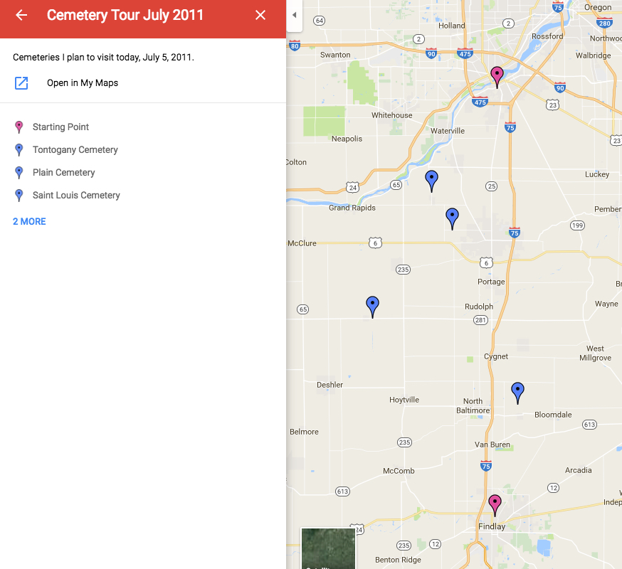
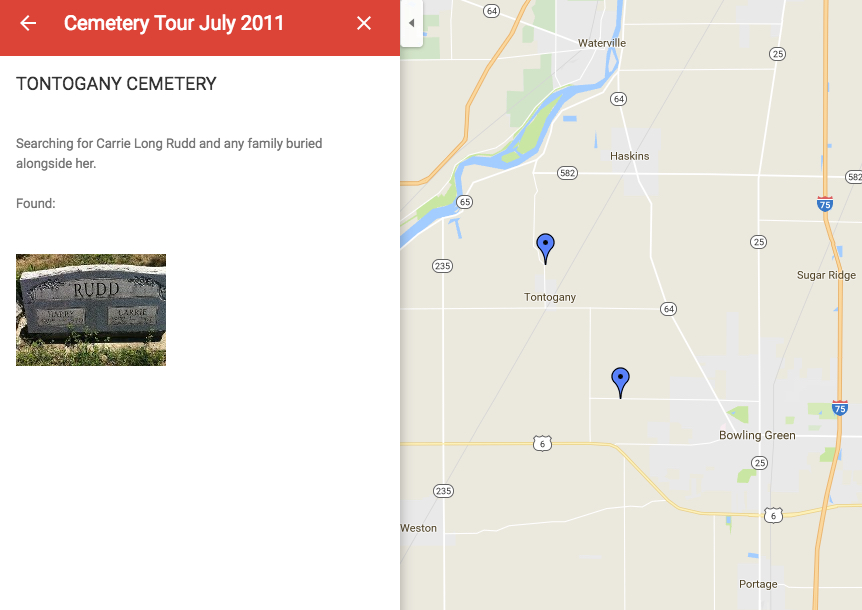
By plotting them on the map, and then zooming in, I was able to plan an efficient driving route. Also, I used this interface to create a research plan. Within each pin, you can create labels and store information. In this case, I recorded whose burials I was hoping to locate within each cemetery. But it also acts like a research log in that while I was in the cemetery, I was able to access My Maps using my smart phone, and added the tombstone photos directly into my map.
I did this for each of the four cemeteries. You may notice that this trip was completed in 2011. Google stores your maps in your Google Drive indefinitely. You can also share your maps (either privately or publicly) so that if you are coordinating a trip with a friend or relative, you can both access and work on the maps.
There are a number of publicly available maps created by other users that you might find interesting. This one on the Civil War (not created by me) demonstrates some of the features such as creating shapes and using color.
In my workshop, I will demonstrate many of the tools you can use to create your maps and demonstrate how to use this to plan research trips, analyze your research, and brainstorm ideas for other applications. You will get to see some of the more in-depth maps I’ve created and get started on some of your own. (Bring a laptop and sign up for a free Google account, if you don’t already have one.)

1 thought on “Learn to use Google’s MyMaps with Me at SLIG’s First Tech Day!”