
After reviewing the census and getting at least a beginning framework for the families I’m researching, I like to turn to land records and maps. This allows me to put the people in a physical location, and in relation to each other.
Illinois is a public land state meaning their lands were surveyed using the rectangular system. For my search I used two online databases to help locate the Scroggins and Dimick families:
- General Land Office, Bureau of Land Management online database
- Illinois State Archives online database
These two databases seem to index the same information, however, you may find that one site is easier to use than the other. The GLO site has the advantage of having maps and original documents attached to the entries. Regardless of which site you use, always use the information to locate your research subjects on a map.
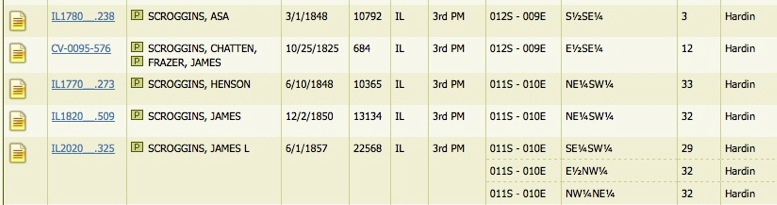
Beginning with the GLO records I found several Scroggins entries in Hardin County, Illinois.


The area in green is where Sanders Scroggins 1855 land is located. (This map can be obtained at the GLO database site.)
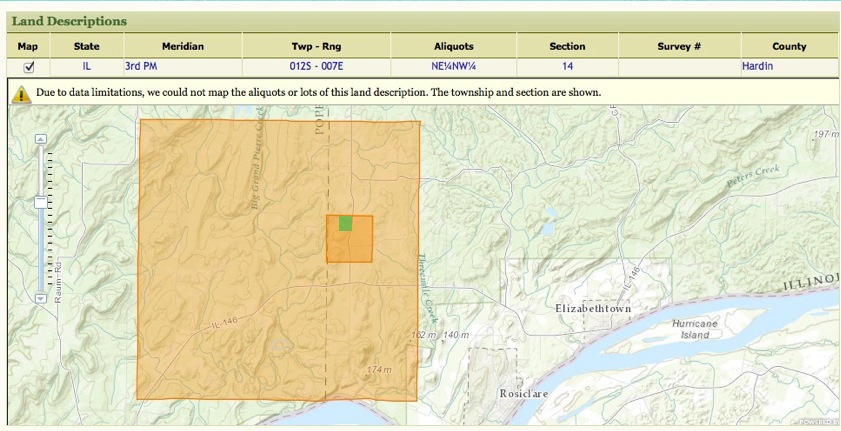
I won’t bore you with all of the maps for all of the land transactions described above, but take a look for yourself if you wish. The GLO database is a rich treasure chest of information. You can find the original land patents and maps showing their locations.
The Illinois State Archives has an index of their Public Domain Land Sales. When searching for “Scroggins” I found the following entries:
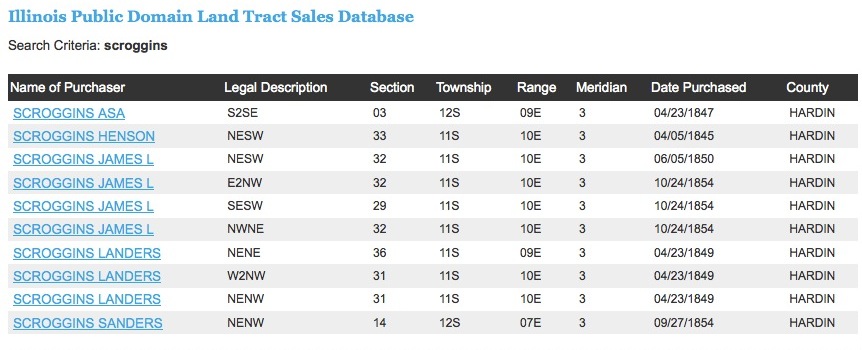 Often a capitalized “S” can look like a capitalized “L” so I am willing to bet that all of those “Landers” Scroggins are really Sanders’ land purchases. The Illinois Archive does not have digitized copies of the originals, instead you will get a transcription.
The next post will discuss the Dimick family’s entries and how the two families relate to each other on a map.
