I wanted to share a tip that recently worked out nicely for me. It has to do with the previous topic of “genealogical persistence.” I’ve been working on disambiguating two men of the same name of about the same age in the same county in Ohio. Last post I talked a bit about some military records. The “other” George Long obtained a War of 1812 pension and in those records, it noted that he also obtained 120 acres of land through a military warrant.
The land for a military warrant could have been located just about anywhere in the U.S. And George Long is a pretty common name. The Bureau of Land Management’s General Land Office (BLM GLO) database and online images is a fantastic resource for people researching ancestors in the Federal Land States (Public Land States). This database holds land records of many types, among them are military warrants.
A wide-open search for “George Long” in any state returns way too many results to find the record efficiently. George’s pension packet shows that he obtained this land after 1871. I know from other research that he died in 1880.
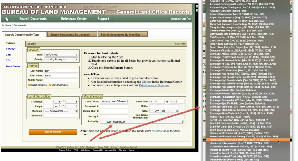
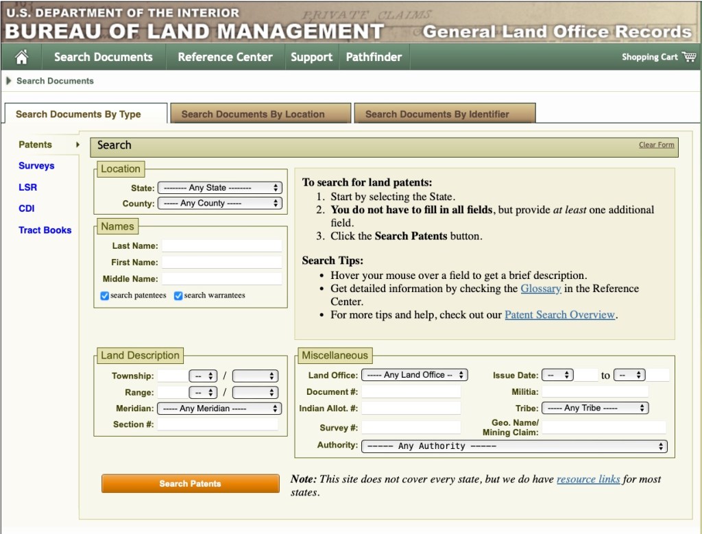
In the “Search Documents By Type” tab, there are a lot of options for narrowing down your search. I tried several. Again, I didn’t know where the land might be located so narrowing down by location wouldn’t work. There is the option to narrow your search down by “Authority,” or by the law/program that the land was disposed under. It is a very long list, and I didn’t see one for “military warrant” or something similar. There are several “Scrip Warrant Act” authorities, but offhand, I didn’t know which one might have applied. (And if it should have been obvious, well, what can I say…sometimes the obvious eludes us.)
My tip is that I used the information I found from his pension packet to narrow down the search by what I know.
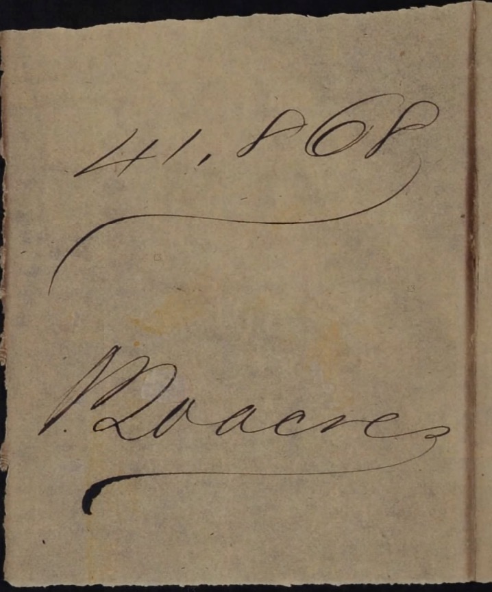
First, I tried looking by warrant number. In his pension packet, there is this note:
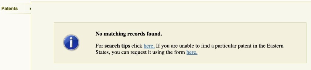
Searching by that number in the “Search Documents By Identifier” tab did not return any results:
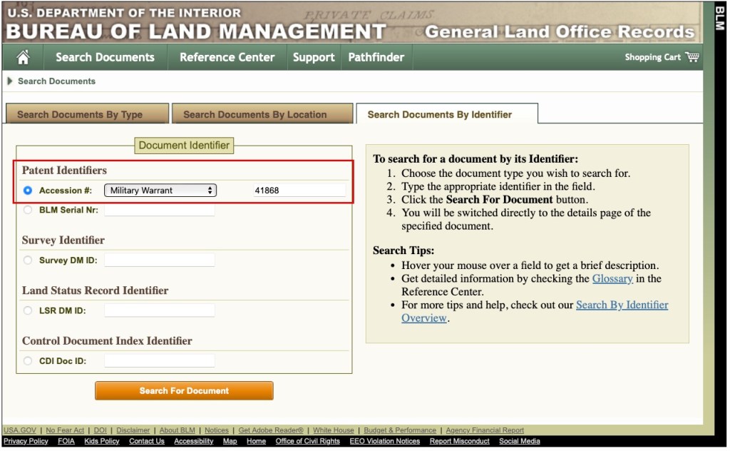
I tried that number in a couple of different fields, on the “Search Documents By Identifier” tab, and could not locate the correct entry.
I ultimately found it by narrowing my search down by date. From the pension I know he obtained the warrant in 1871, and he died in 1880, so I narrowed by search by those dates.
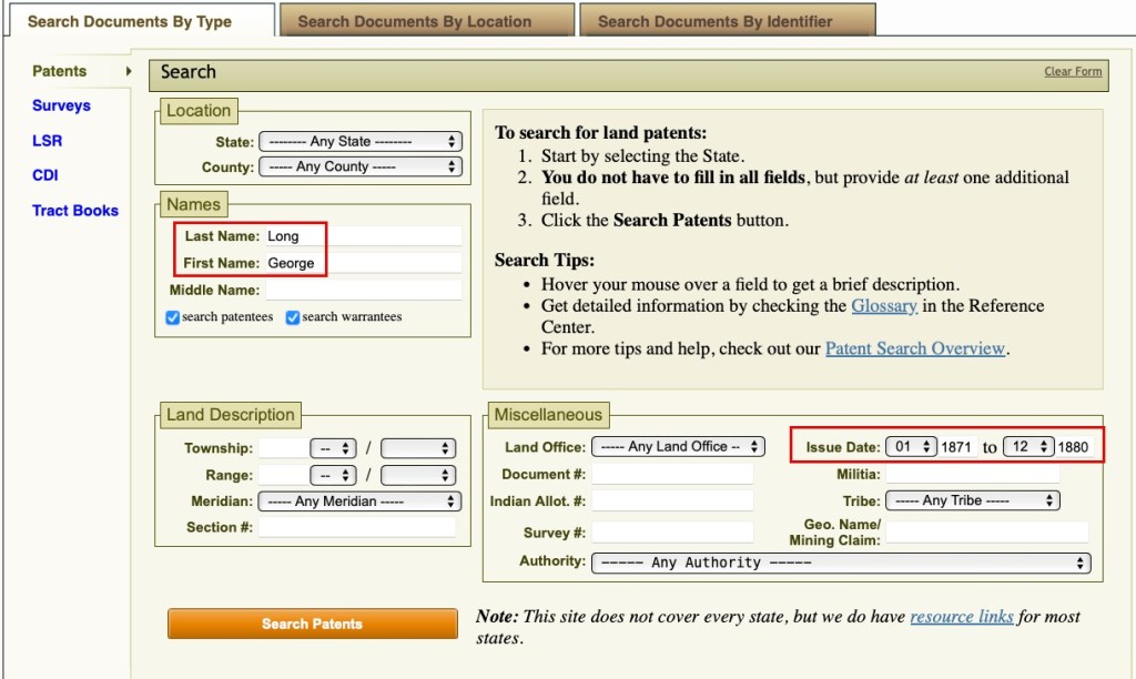
I then also noticed the “Document #” field in that same “Miscellaneous” section (see, the obvious doesn’t always jump out at you).
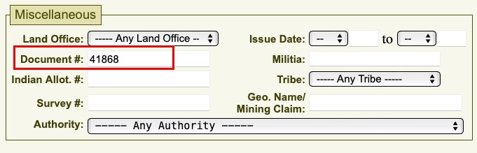
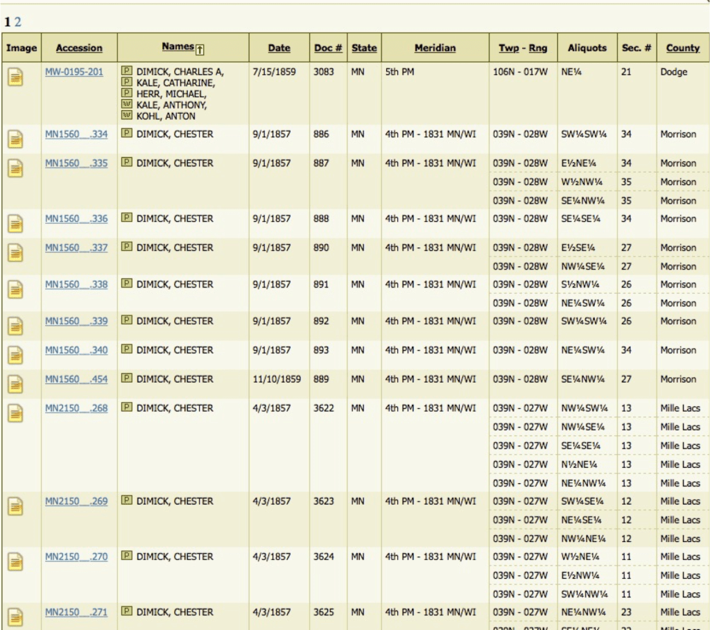
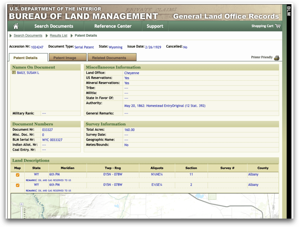
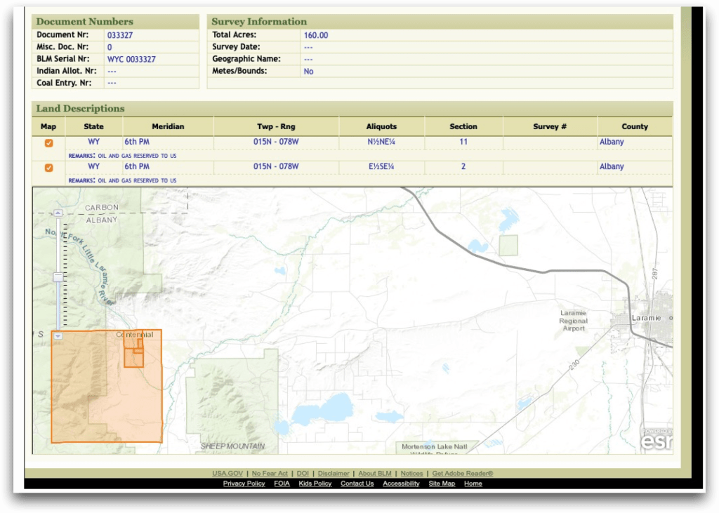
Here is “other” George Long’s entry:
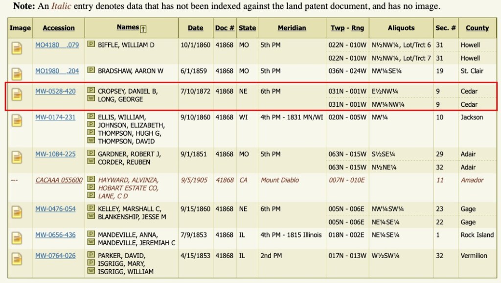
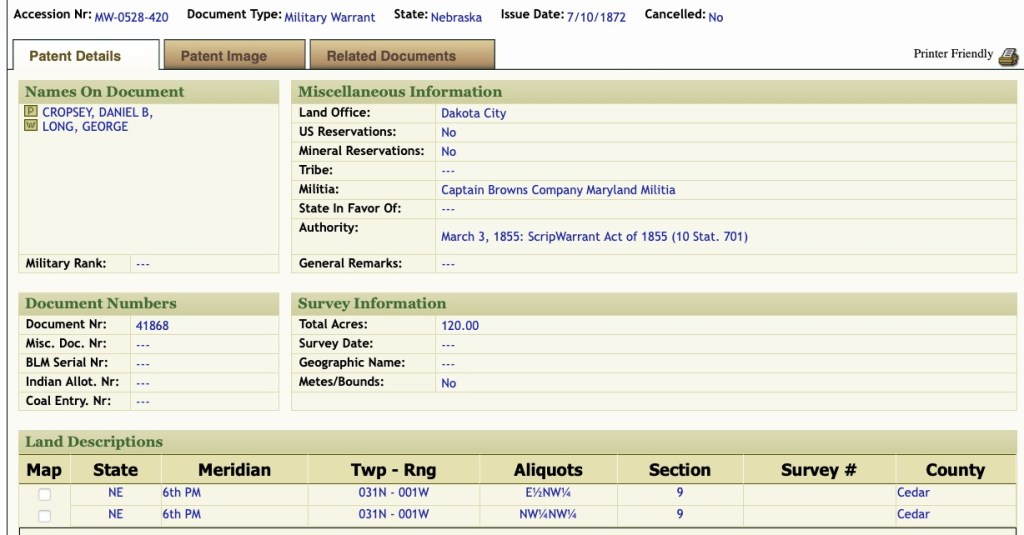
The entry shows the correct militia: Captain Brown’s Company Maryland Militia. The document number and the number of acres match. I would never have known to look in Nebraska.
If I had to try every option on this database, I was going to, because I knew this record had to be in there. I have the feeling that some people are going to write me and say something like “I knew that” or give me some kind of tip for using the site… and if you do (or are tempted to), you are missing my point.
My point is, we don’t know everything … not about every website and how they work and how the data was cataloged. And if you ever encounter a site that’s not as familiar to you, you have to figure out how to work it to your advantage. This is an example of taking known information and narrowing down results to find what you need… It’s not about using the BLM website per se. This is an example of genealogical persistence.
Long story and many screenshots to say keep looking, trying, clicking, and searching! Something will eventually work, I’m certain of it.