The second section I like to include in my locality guides is a geography section. Nothing helps you understand a new location like maps do. So, my guides collect links to a variety of maps that depict various aspects of the locality that is the focus of the guide.
I either add the actual item, but more often a link to:
- General county map indicating townships, towns, land divisions
- Landowner or plat maps
- Topographical maps
- Town maps showing streets
- Modern maps
There are some great general map collections out there that you can use to find useful maps and links, such as:
- Perry Casteñeda Library
- David Rumsey Map Collection
- HistoryGeo.com
- Library of Congress, Maps
- Newberry Library, Atlas of Historical County Boundaries
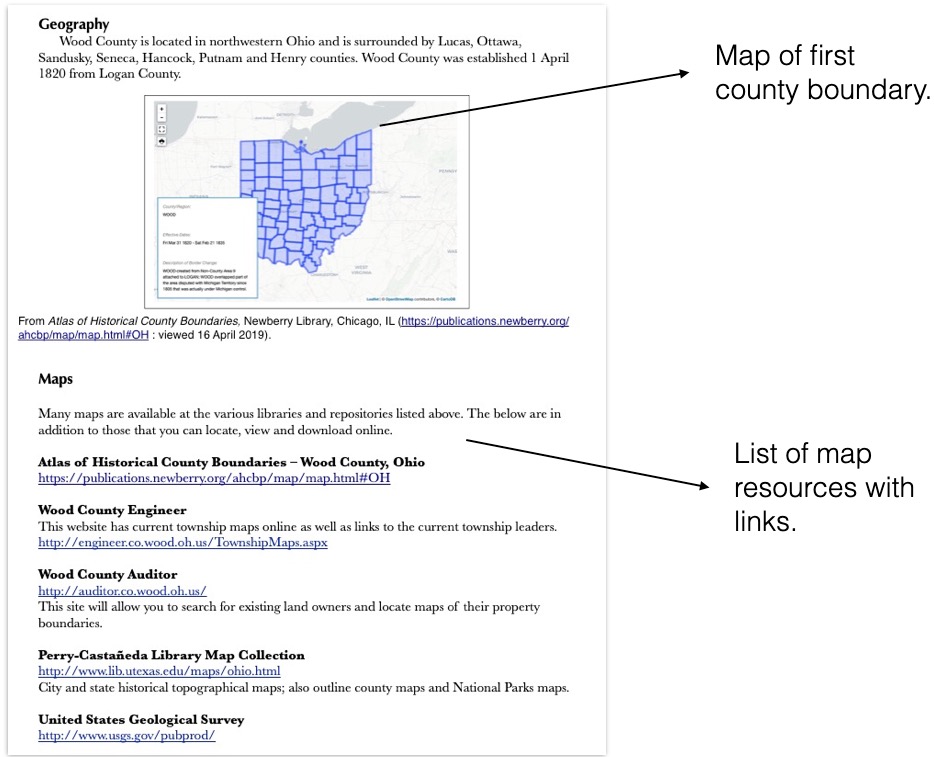
But also, don’t forget to check for local sources. You may find digital maps at local public libraries, genealogical or historical societies, university collections, museums, county government office websites, and more. For example, in Wood County, Ohio, the County Engineer’s office has a variety of maps available on their website such as tax maps, township maps, cemeteries, ditch maps, plat maps, and many others.
Except for a general county map and possibly a township map, I mostly just collect the links to important maps rather than adding actual images to my locality guide. This saves space, primarily. However, if you want to include maps directly in your guide, you should feel free to do as much or as little as you like. Always do what works best for you!
Next week we will move on to the Records section of the guide.
