When working with ancestral land records, there are a few things you need to know in order to attempt to find your ancestors’ land on a map. In the United States there are two types of land surveying systems. They are known as the “state land states” which use the “metes and bounds” system, and the “public land states” or the “federal land states” which use the “rectangular” survey system.
The states that fall into the state land state category are those states created from the original thirteen colonies and Hawaii and Texas. (As a side note, Texas has its own land survey system because Texas was a country of its own before joining the U.S., with their own survey system already in place. See the Texas General Land Office for more information.) Those states are:
- Connecticut
- Delaware
- Georgia
- Hawaii
- Kentucky
- Maine
- Maryland
- Massachusetts
- New Hampshire
- New Jersey
- New York
- North Carolina
- Pennsylvania
- Rhode Island
- South Carolina
- Tennessee
- Texas
- Vermont
- Virginia
- West Virginia
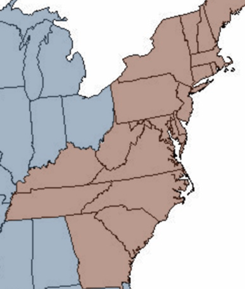
The land obtained by individuals for the first time usually was given by the colony or state. Records for those first land grants are kept at the state level, usually at a state archive, though the locations will depend on the state. Again, the state land states were surveyed using the “metes and bounds” survey system.
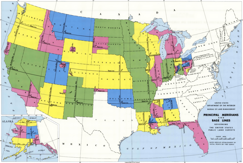
The Federal land states or “public land states” was land obtained by the federal government after independence. This means the rest of the United States. Primarily the land west beyond the Appalachian Mountains. After the Revolutionary War, land claimed in this western portion by state land states were ceded to the federal government. Additionally, the United States obtained land through various means such as the Louisiana Purchase, the War with Mexico (1846-1848), and so forth.
The land in the public land states would then be granted to individuals by the federal government. Those records are held at the national level, and many are digitized and available at the Bureau of Land Management General Land Office website. The land in the public land states were surveyed using the “rectangular” survey system.
When looking at a land description, you can usually determine quite quickly if you’re reading a metes and bounds or a rectangular survey. We will discuss the metes and bounds system next and the rectangular system after that.

1 thought on “Maps: Visualizing Your Ancestors – Land Descriptions”