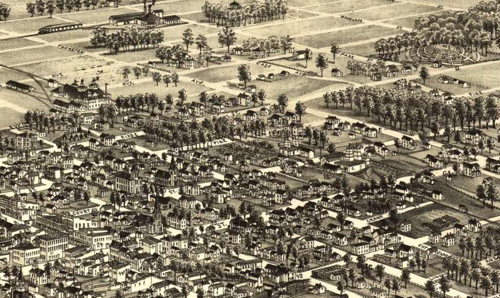
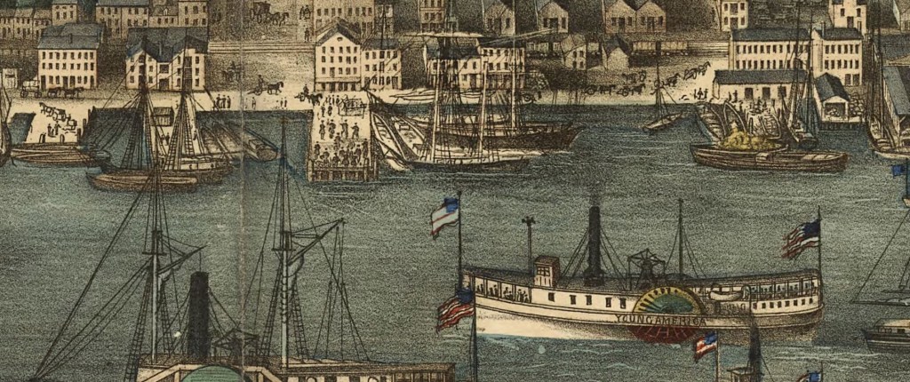
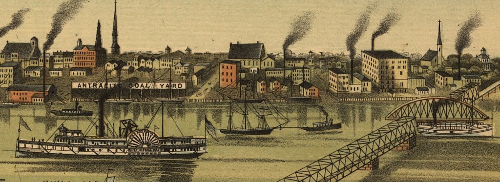
One of my favorite types of maps, especially for enhancing your imagination when thinking about your ancestors, is the bird’s eye view map. These are intricately drawn maps were popular in the late 1800s and early 1900s to depict towns and cities from above. These maps might be called other names such as panoramic maps, perspective maps, or aero view maps.
These maps may not be drawn to scale but rather they depict streets, buildings, waterways, and city life. Many of these are so intricate that if you zoom in you can see horses and buggies, names on the ships in the harbor, people walking, and more. They are art the informs our ancestors’ surroundings. For me, they are almost like stepping into a time-travel portal. Almost. They are so much fun to look at and imagine with.
Here are a few zoom-ins on some of my favorites:
I could go on… instead. I encourage you to visit the Library of Congress collection of panoramic maps or any online map repository, and see the fun for yourself!

 I am registered to attend the
  The
The 