Tag Archives: topographical map

Maps: Visualizing Your Ancestors – Finding Topographical Maps

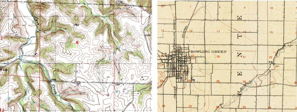
One of my first places to look for topographical maps is the United States Geological Survey (USGS) website. Beyond just being a cool site to check out, it offers all kinds of digital maps. We will focus on the topographic (topo) maps for today, but I encourage you to check the site out for general interest if nothing else.

USGS Website – Scroll down the page
Find the topographic maps section.

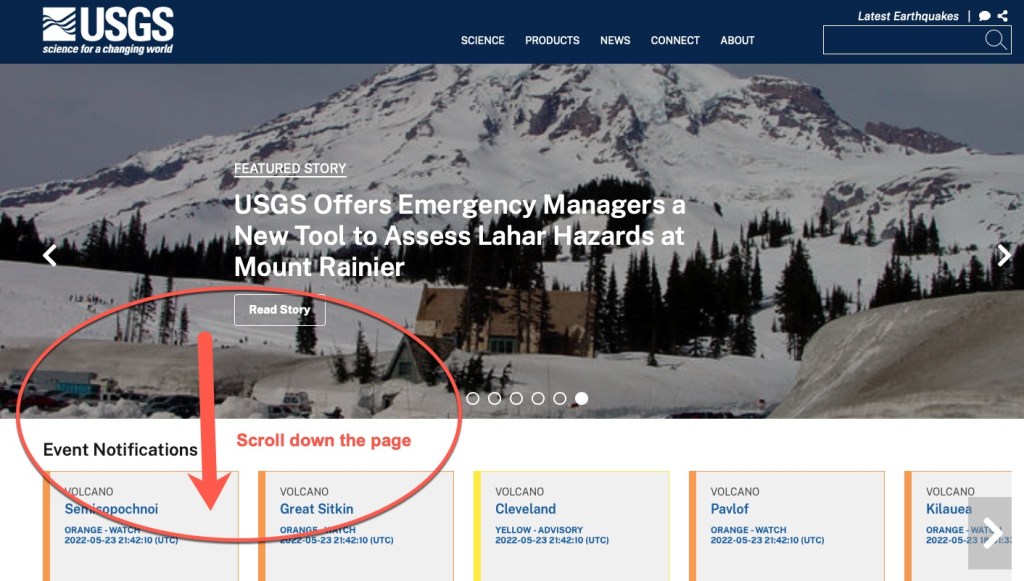
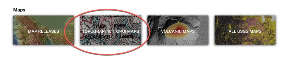
When you click on that Topographic (topo) Maps section, you will be taken to an interactive map. Simply type in a location in the upper right search box, or click anywhere on the map and zoom in to find your location. A list will appear below the search box showing you all of the maps they have published for that area. When I searched for Lyme, NH, I found maps for the area going back to 1933.

Lyme, New Hampshire Topo map from 1933, showing “Demmick Hill”

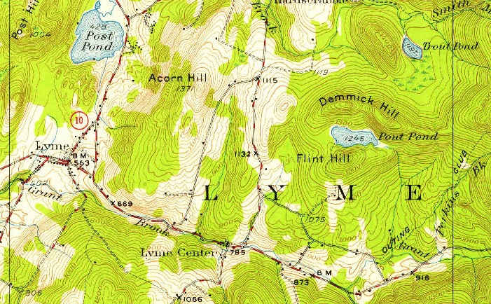
Above is the section of the map showing Lyme where my Dimick ancestors lived. There is even “Demmick Hill” on the map where they used to cut ice blocks out of “Pout Pond” and slide them down the hill to town for people to use in their ice boxes before refrigeration. Because of this topo map, I can see where this event occurred with a better visualization of the landscape.

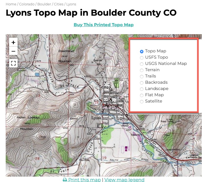
Another site to try is TopoZone.com. They also use the USGS maps, but you might find their search or website tools easier to use. For example, they have layers that you can turn on and off that might help you enhance what you are looking for.

Topozone Map of Lyons, Colorado, showing the layer options.

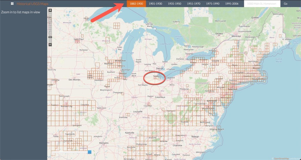
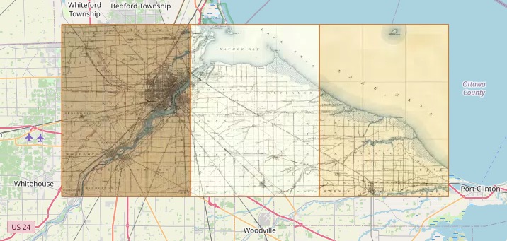
Another site that uses the USGS as well as other historical maps is called “Historical USGS Maps” and this site puts all of the maps on a large interactive map. You simply zoom in and move around to see what is available. Along the top they have a timeline so you can see the time periods for the maps available.

Historical USGS Maps example, showing timeline at the top and circling maps in the Toledo, Ohio area.
As you zoom in, the maps available appear, overlaid on the main map.

You can find websites for other countries as well (not at all meant to be an all-inclusive list, just some I’ve run across in my research):

Be sure to use Cyndi’s List for links to maps (and other topics). We will look at plat maps next time.

Maps: Visualizing Your Ancestors – More Thoughts on Topographical Maps

Last time we talked about topographical maps and using them to understand why ancestors might have migrated one way over another. Primarily looking at large land formations, like mountains. Let’s look at a topographical map on a smaller scale.

When you are looking at a topographical map, you will see lines that indicate changes in elevation, and if you “squint” at the map you can kind of imagine how flat or hilly an area might be. A topographical map shows you the contours of the land indicating mountains, valleys, rivers, vegetation (or the lack thereof), and other features. On a topographical map, you will see large swathes of green for vegetation, blue areas for water, grey areas for buildings and built-up areas. However, the contour lines tell the story of the three dimensional nature of the landscape.

Depending on the map, there will be a key that tells you at what elevation another contour line will be placed on the map. For example, if the map you are looking at uses a 10-foot contour spacing, then you will see a contour line for every 10 feet of elevation change. (i.e. a line will be in place at 0-, 10-, 20-, 30- foot change. A map might use a larger scale if the land is very elevated, showing the Rocky Mountains, for example. The lines on the map are only drawn for every interval of change, so every 10 feet, for example. If you have a relatively flat area of land, the map might be quite blank of the contour lines.

Let’s look at two examples. The map on the left is in Audrain County, Missouri, the map on the right is in Wood County, Ohio.

Topographical maps of Audrain County, Missouri on the left and Wood County, Ohio on the right.

You can see the difference in the land shapes even though I’ve zoomed in a different levels. Wood County, Ohio is very flat, whereas Audrain County, Missouri is much more hilly. I have ancestors that farmed on land from both of these maps. And each map gives me a bit of a different picture of how that farming might have happened. Audrain County land probably couldn’t farm right up to the river banks due to the steepness and vegetation. Those green areas indicate a lot of trees and vegetation where the white areas were clear and flatter, better for farming. And while there are some swaths of trees in Wood County, most of the thickest parts have been cleared out and the land is largely flat farm land for miles.

We will learn about where to find topographical maps next time.

Maps: Visualizing Your Ancestors – Types of Maps – Topographical

When it comes to understanding ancestral migration patterns, it really helps to look at a map. The reason an ancestor ended up in a certain location might be explained by geography, and more specifically, topography. Using a topological map can be quite helpful in understanding some of the potential “whys” for things our ancestors did.

Topography is “the arrangement of the natural and artificial physical features of an area.”1 Examining the physical features can explain a possible migration route or why they stayed in a particular location.

One excellent example of topography affecting migration is that of large mountain ranges. Let’s look at Virginia as an example. Let’s say you had ancestors in early Virginia and they wanted to move west to the “frontier.” They set off past Richmond only to discover a large mountain range in front of them. The Blue Ridge Mountains caused a lot of adventurous folks to head north or south to go around them.

Map of Virginia from FreeWorldMaps.net

This barrier caused more settlements to the north and south. As I imagine it, you make a long journey to get around these mountains…why not just stop here a spell? And then just never leave. I imagine that happened quite a bit.

My ancestor, Samuel Cook Dimick, moved from Lyme, New Hampshire to Toledo, Ohio. One account says that after the business he was working for began shutting down (or he decided to quit working there, it isn’t clear) he was to move on further west (perhaps to Minnesota where his father owned some land). But someone told him of land for sale just one county to the south and he decided to stay in Wood County, Ohio. And that’s the reason I was born in Wood County, Ohio and not Lyme, New Hampshire.

We will continue our look at types of maps that can help us understand our ancestors’ decisions and circumstances next time.


1. Definition of “topography” from Oxford Languages (https://languages.oup.com/google-dictionary-en/)↩