To understand our ancestors’ movements and decisions, sometimes consulting a map can clear up confusion. I have a simple example from my own research.
One of my favorite lines to research are the Dimicks. They moved from Massachussetts to Connecticut to New Hampshire and then later to Ohio. I find that I try to do too much in my head sometimes. My brain likes to try to convince me that I can remember things…corrrectly. Well, this demonstration just goes to show two things. One, I can’t remember much very well, and two, using a map is invaluable.
Here’s how I “thought” their migration went:
It is an unusual migration pattern to cross back over a state you’ve already left. It’s not unheard of or impossible, of course, but usually, people migrated in more of a straight line. This realization got me to look at the exact locations of the Dimicks in each location.
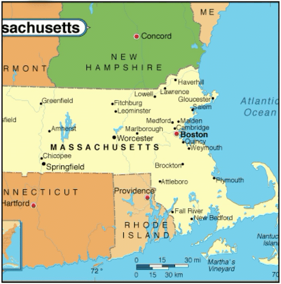
When the Dimicks arrived in America in the 1600s, they lived in Barnstable, Massachussetts, which is located out on the hook of Massachussetts. Now this migration makes more sense:
By looking at a map, instead of depending on my memory, the Dimick migration makes a whole lot more sense. This is now one of the first things I do when working on a project. I look at maps and get a good visual perspective on where all of the people involved were located.
There are several types of maps that can be useful for this. We will look at them in more detail next week.

This is a valuable lesson. I had not thought of incorporating maps into my ancestors’ timelines. Now a light bulb is on. Thanks for flipping the switch. I am looking forward to the rest of the series.