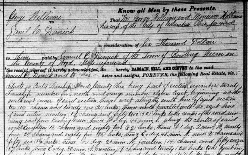
There were a few statements in S. C. Dimick’s biographical sketch that led me to examine land records.
First: “In 1875, we find him a resident of Center township, Wood county, where he purchased 120 acres of the old Williams farm, and has here since made his home. He has one of the best orchards in the township, and his excellent farm has been brought under a high state of cultivation by industry and good management, with its attendant hard labor.”
Wood County, Ohio, Deed Book 48:123 (1876), County Recorder’s Office, Bowling Green, Ohio; FHL microfilm 409,648.Close-up, describing the 120 acres purchased.Ohio, Wood County, 1886 (Philadelphia: Griffing, Gordon & Co., 1886), 17; digital image, Historic Mapworks (www.historicmapworks.com : accessed 15 March 2015).
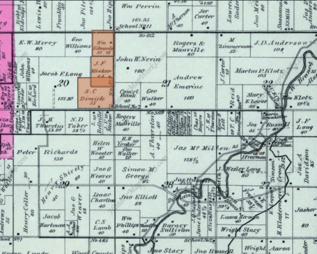
This map shows approximately where that 120 acres were located. This is after he sold some of the 120 acres to some relatives of his daughter-in-law.
Samuel bought this land outright. It was not a military warrant, or homestead, or some other acquisition from the Federal Government. So, this did not answer why he moved his family to Ohio. We will keep looking at the clues.
One type of map that can be helpful to pay attention to are boundary maps. I’m usually focusing at the county level. I have a couple of ancestors who were “border dwellers” meaning they lived on or near a county boundary. Sometimes I find records for them in one county, sometimes another. What is going on there? Did they move? Or did the county boundary change? OR, a third option, was the nearest courthouse in the next county over? Some court actions did not have to be in the county where a person lived so it may have been more convenient to go to a neighboring county to file that record.
I usually use a county map that is at least at the township level, and I typically use them in conjunction with a landowner map. You have to know where exactly in the county (and township) someone lived to understand if they moved or if the boundary changed.
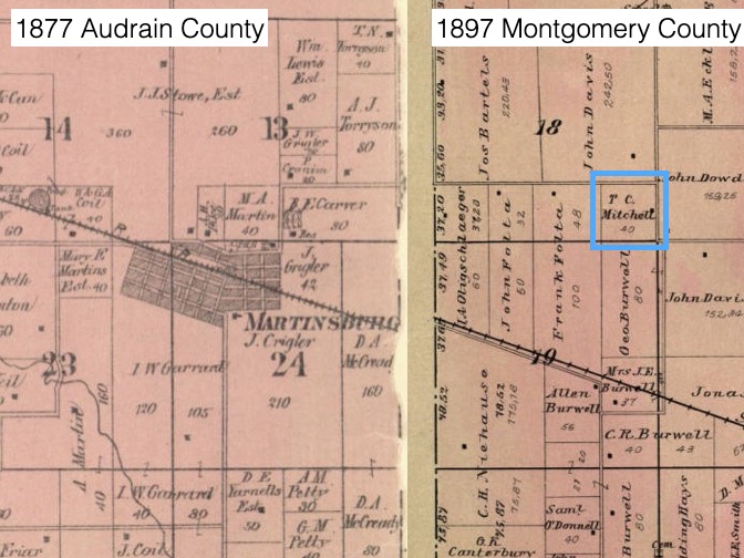
One of my favorite ancestors to research is Thomas C. Mitchell. After the Civil War, he lived in Montgomery County, Missouri, but right on the border with Audrain County.
Two landowner maps showing T.C. Mitchell’s proximity to the border.
Sometimes you cannot find a map for exactly the right time frame. Simply find the next closest and use that for your comparisons and analyses. In my example above, you can see the map on the left is from 1877 Audrain County and the map on the right is 1897 Montgomery County. I lined them up as best as I could using the train line as a guide.
These township maps show you the section numbers; Thomas lived in section 18 in that particular Township/Range. We know that each section is one square mile. That means that Thomas lived about 1.5 miles from the nearest town of Martinsburg. If he could do the business he needed to do, you can bet that he did it in Martinsburg. I have found many records for Thomas in Audrain County even though he lived in Montgomery County.
If your ancestor never moved but the county boundary changed, you have to look for records in both counties. The county clerks did not sit down and divvy up the records according to those that lived in the new county. They just kept the records in their original location. So, for border dwellers, always be checking nearby counties. A landowner and county boundary map can help you decide in which counties to look.