When looking at the details found in Samuel C. Dimick’s biographical sketch, let’s start with a basic one. Let’s look at him in the census. For each of my research subjects, I try to find them in every census they should be in. For Samuel, we will just look at a couple that I focused on because I primarily wanted to know why he came to Ohio from New Hampshire. We can’t always answer ‘why’ questions in genealogy but we can make some good educated guesses if we find the right information. So, I wanted to figure that out if I could.
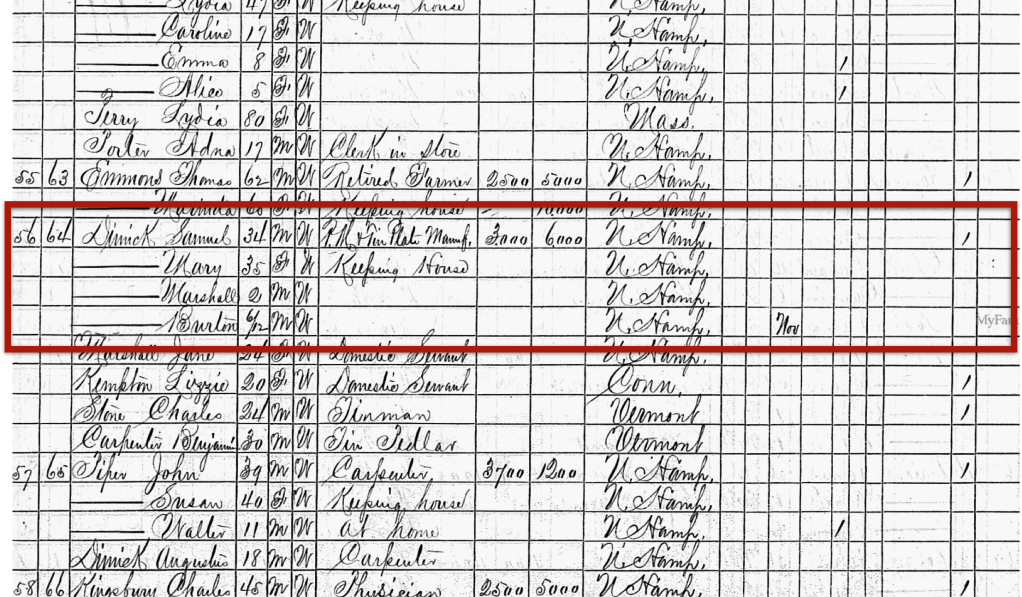
1870, Lyme, Grafton County, New Hampshire
In 1870, Samuel was living with his wife Mary in Lyme, New Hampshire. He was 34, she was 35, and they had two sons, Marshall, age 2, and Burton, age 6 months. Samuel’s occupation is hard to make out, but it looks like “R.M. & Tin Plate Manuf.” I only knew he was a farmer from my earlier research.
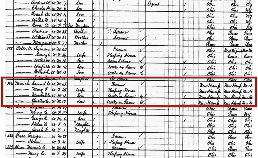
1880, Center Township, Wood County, Ohio
By 1880, he was living in Center Township in Wood County, Ohio, which is near Bowling Green. He is listed as a farmer.
These two censuses at the bookends to his migration to Ohio. Sometime between 1870 and 1880 he and his family made the move. We will continue to look for clues about his life in the county history and see what more we can learn.
In the last blog post, we looked at the general family information we found in Samuel C. Dimick’s biographical sketch. Now let’s discuss all of the minutiae and details that we (and by ‘we’ I mean I) might gloss over the first (or second, or tenth) time we read a biographical sketch.
When I began researching Samuel, I didn’t know anything about him, of course, so the details that were important to me at that time were the main biographical points we looked at in the last post. However, as time moved on, I gained more experience, and I wanted to know more specific information about him and his family, I started focusing on some of that minutiae. Sometimes we just aren’t ready to absorb information from a source. And that’s ok, as long as at some point in your process (this could be many years later), you go back and review your previous research.
After really digging into the details, I was able to compile a list of other sources I needed to examine to verify those details and get more information:
Census Records
Newspapers
Obituaries
Land Records
Land Ownership Maps
Vital Records
City Directories
School Records
Agricultural Census
Indian Reservation Records
Revolutionary War Records
Expand search to other states mentioned in the sketch: New Hampshire, Wisconsin, Massachusetts, Minnesota
Over the next several posts, we are going to look at some of these in detail. I won’t go over each and every one, because, well, that could get boring. But, there are some highlights I want to hit that really opened some new research avenues and helped me understand Samuel’s life better and in more detail.
“We now come to the personal history of our subject, who, after attending the district schools of Lyme, entered the high school of Orford, N. H., where he completed his education. After working on his father’s farm for a time, he removed to Wisconsin, where he was in the lumber business for a year, and, on the expiration of that time, went to southern Minnesota, where for a year and a half he had charge of a government farm on the Indian reservation…
“In 1875, we find him a resident of Center township, Wood county, where he purchased 120 acres of the old Williams farm, and has here since made his home. He has one of the best orchards in the township, and his excellent farm has been brought under a high state of cultivation by industry and good management, with its attendant hard labor…
“Mr. Dimick was married at Lyme, N. H., in 1860, to Mary Marshall, who was born in 1835, and they became the parents of two children, the younger of whom, Burton C., born November 4, 1869, died July, 1889…
““…Marshall C., born December 13, 1867, was educated at Toledo and Bowling Green, and now has a half-interest in the homestead farm, to the cultivation and improvement of which he now devotes his energies. He is a young man of good address, genial and industrious, and is one of the most enterprising and progressive farmers of Center township…”
I only shared some of the most vital or interesting bits about Samuel in the quotes above. In the full sketch, some of the things we learned about him include:
Born: 23 June 1835, Lyme, New Hampshire
Married: 1860, Lyme to Mary Marshall
Children: Marshall Chester and Burton Cook
Occupations: Farming, lumber, hardware store, can manufacturing
Other locations: New Hampshire, Minnesota, Wisconsin
Land ownership: bought 120 acres of the “Old Williams Farm” in Wood County, Ohio
Extensive details on Mary Marshall’s family background
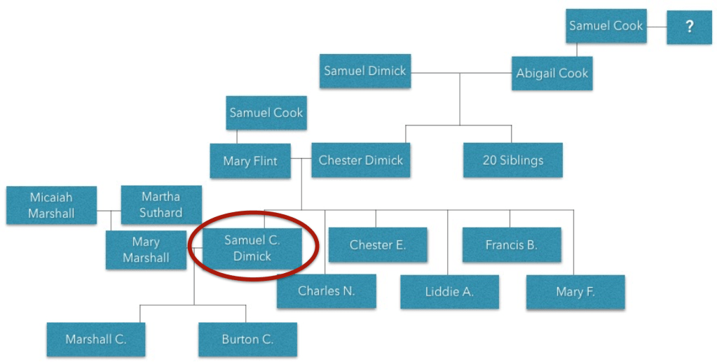
We have also been able to reconstruct family groups from this biographical sketch. Here is what we learned about Samuel:
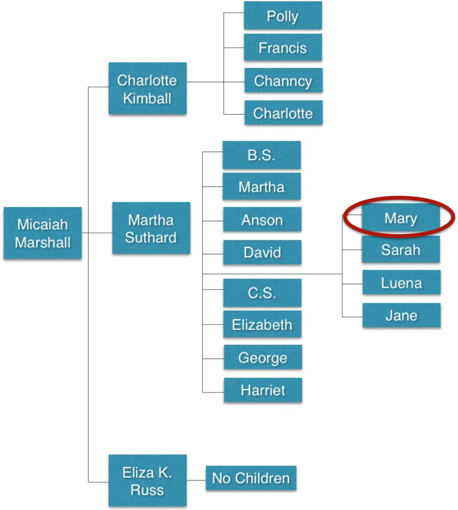
We were also able to reconstruct his wife’s family:
Next time, we will start looking at some of the information in more detail and discuss following every lead from these sketches.
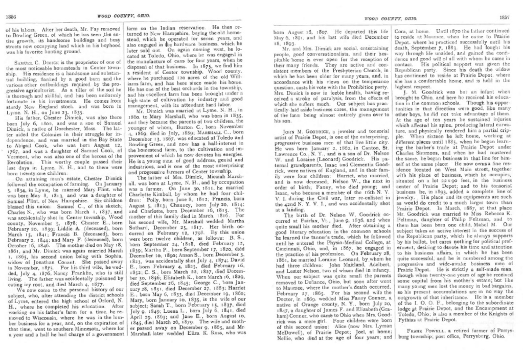
Biographical Sketch of Samuel C. Dimick in the county history for Wood County, Ohio.
I know this image is incredibly tiny and I’m not expecting you to read it. I’m going to share some of the main points and highlights and some things I’ve learned and some things I’m still working on from this particular biographical sketch. If you want to read the sketch in its entirety, click here.
Samuel Cook Dimick is one of the ancestors I focused on early in my genealogy-hood. My paternal grandmother, Marge, was a Dimick. She was very interested in the Dimick family history and we were able to take her on a trip to New England to visit some ancestral towns and cemeteries. She had a copy of this book in her possession. So this was a book I was familiar with early on. This biographical sketch shares so much information about Samuel C. Dimick and alerted me to things I had not found in other records.
The sketch contains many of the usual things you would find such a general genealogical birth, marriage, death information.
“Samuel C. Dimick is the proprietor of one of the most noticeable homesteads in Center township… He comes from sturdy New England stock, and was born in Lyme, N.H. on June 23, 1835… “His father, Chester Dimick, was also there born July 6, 1802, and was a son of Samuel Dimick, a native of Dorchester, Mass. The latter aided the Colonies in their struggle for independence, and was married in the Bay State to Abigail Cook, who was born August 12, 1767, and was a daughter of Samuel Cook, of Vermont, who was also one of the heroes of the Revolution. This worthy couple passed their last days in Lyme, N. H. and to them were born twenty-one children.”
Pretty typical of general biographical sketches in county histories. This one traces ancestor back to the Revolution. The county histories generally were a celebration of our immigrant ancestors the formation of the country. We will continue exploring this sketch in future posts.
If you haven’t used a county history or found your ancestors in one, I encourage you to look. Later in this series we will get to some search and locating techniques. Let’s discuss what you might expect to find in a county history.
Many county histories have two parts, even if they are not formally called out. Generally speaking, there is the part that discusses the history of the county, of the place, itself. This section will contain information on topics such as: early geography, geology, Native American tribes in the area, early settlers, the first towns in that county, the first government officials, the first churches, schools, and so on.
Table of Contents from the Wood County, Ohio county history.
From the table of contents for the history from Wood County, Ohio, you can see several topics just from this one section of the page that would be of interest to genealogists: newspapers, medicine, military, churches, schools, early pioneers, agricultural societies, etc.
You might find more modern publications such as Patterns and Pieces from Lyme, New Hampshire. As you can see, many similar topics are included.
Title page from Patterns and Pieces.
Then there is the second section, the section with the biographical sketches of our ancestors. These biographical sketches usually followed a male and his lineage back to the immigrant ancestor. Sometimes you will also get a lineage from his wife back to her immigrant ancestor, usually along her father’s line. If you are lucky, you might find a photograph or a sketch of your ancestor (I have not been that lucky yet.)
Next time, we will look at one of my favorite biographical sketches.
County histories have been a huge help to my research over the years and so I wanted to take some time to discuss them. There are definitely pros and cons when it comes to working with county histories. Big pro, often they were informed by family members, people who should know the data being published. Big con, there are rarely citations, well because of the previous “pro” mostly. Why would you give a citation for something you know from firsthand knowledge or at the very least, family lore?
The author’s copy of the county history for Wood County, Ohio.
County histories are, well, histories of a particular county. You may also find regional histories that encompass several counties in one. Primarily, they provide a history of the area and sometimes biographical sketches of many of the citizens of that county. They are sometimes called “mug books” or “vanity sketches.” Traditional county histories were published by companies who sold “subscriptions” to the book in order to have a family’s sketch included. You may also find county histories that were funded as a project by a county or town for an anniversary, or by a historical or genealogical society in that town.
Generally speaking, county histories became popular around 1876, at the centennial of the United States, and typically followed the lineage of that family back to their immigrant ancestor as a way to celebrate the growth of the nation. These books were published for about a 45-year period until about 1920. You may also find some books that could be considered county histories published near the bicentennial in 1976. Some of these later publications may be in the form of oral history interviews and recollections.
These county histories are not just an excellent source for a large amount of information about a family, they also contain valuable information about the formation of the county or region as well. Over the next several weeks, we will look at county histories, many as they related to personal research projects and how they guided my research.
There’s two ways you can use Cyndi’s List (ok, maybe there’s more than two, but I’m going to demonstrate two in the next couple of posts). This week let’s talk about how you can use Cyndi’s List if you don’t have a plan, or a Costco shopping list if we stick with that metaphor.
When you walk into the big warehouse store with no list, what do you do? You start walking up and down the aisles and see the items with no plan. This is a fine way to do things on Cyndi’s list and a very viable way to learn about what you don’t know. Let’s walk down the “aisles” of Cyndi’s List.
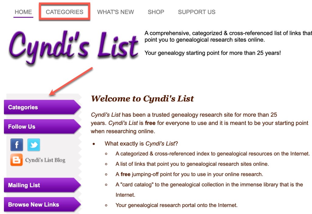
To find the “aisles,” go to the Categories tab at the top of the screen, or the first purple button on the left:
Showing the Categories tab and button on Cyndi’s List
What you will first see is probably an ad. Remember from last post, all you have to do is click the close button to move on. (Also remember that this is a completely free resource and Cyndi funds it through ads and donations. Running a website of this size is not cheap.)
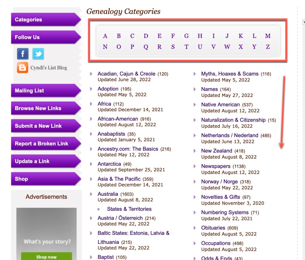
Once you’ve found the “aisles” (the categories), you can start browsing. Along the top is an alphabet so you can jump to that letter in the categories list. Or you can just scroll down the page to see what you find. Again, you don’t know what you don’t know. So this kind of browsing reveals some of those things to you.
Alphabet across the top to jump to a topic or scroll the categories.
You can see from the list above, it is two columns. and from these you can see some of the categories: “Acadian, Cajun & Creole,” “Adoption,” “Africa,” “African-American,” etc. There is a number in parentheses after the title of the category that indicates how many links are in each. So, Adoption, for example, has 195 links in the category at the time of this blog post. Below each category, there is a date that the category was last updated So, adoption was updated in May of this year, whereas, Novelties & Gifts (on the right hand column) has not been updated since November 2020. As I said last time, Cyndi’s List is a one-woman operation. She fixes broken links nearly every day (I asked).
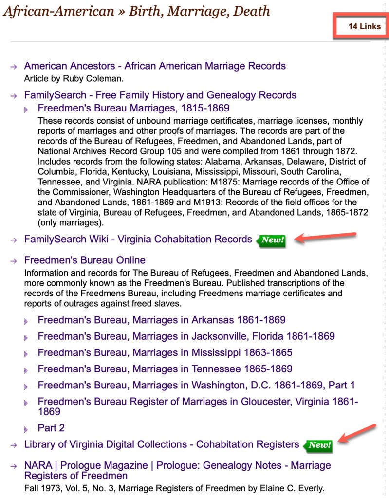
Let’s look at the African-American category. It was last updated very recently, on 12 August 2022. It contains 916 links. When you click on the African-American category, you will find all of the subcategories and related topics.
African-American category on Cyndi’s List
The sub-categories in each is listed in alphabetical order. She is constantly working on these categories and massaging them to keep them updated. Some of the sub-categories in this section include: “Birth, Marriage, Death,” “Blogs, Podcasts, and Video,” “Cemeteries & Funeral Homes,” “Freedmens’ Bureau,” “Laws & Statutes,” “Occupations,” “Slavery,” “Social Networking,” “Societies & Groups,” and “Wills & Probate,” to name several (but not all).
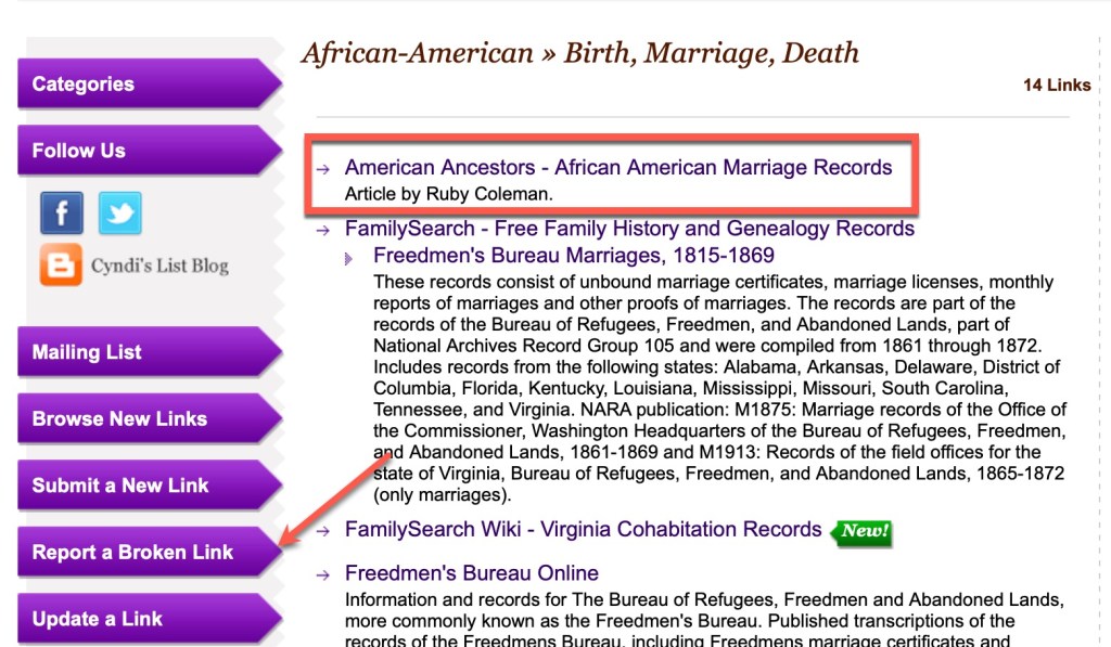
Let’s look at the “Birth, Marriage, Death” category.
Birth, Marriage, Death sub-category
There is a link count at the top that tells you that there are 14 links in this sub-category. Each recently added link gets a “New!” icon so you can see some of the newest resources added.
As I was browsing the items in this category, I found that the first link, that to an article by Ruby Coleman at American Ancestors, is broken. It points to this:
Broken link at American Ancestors
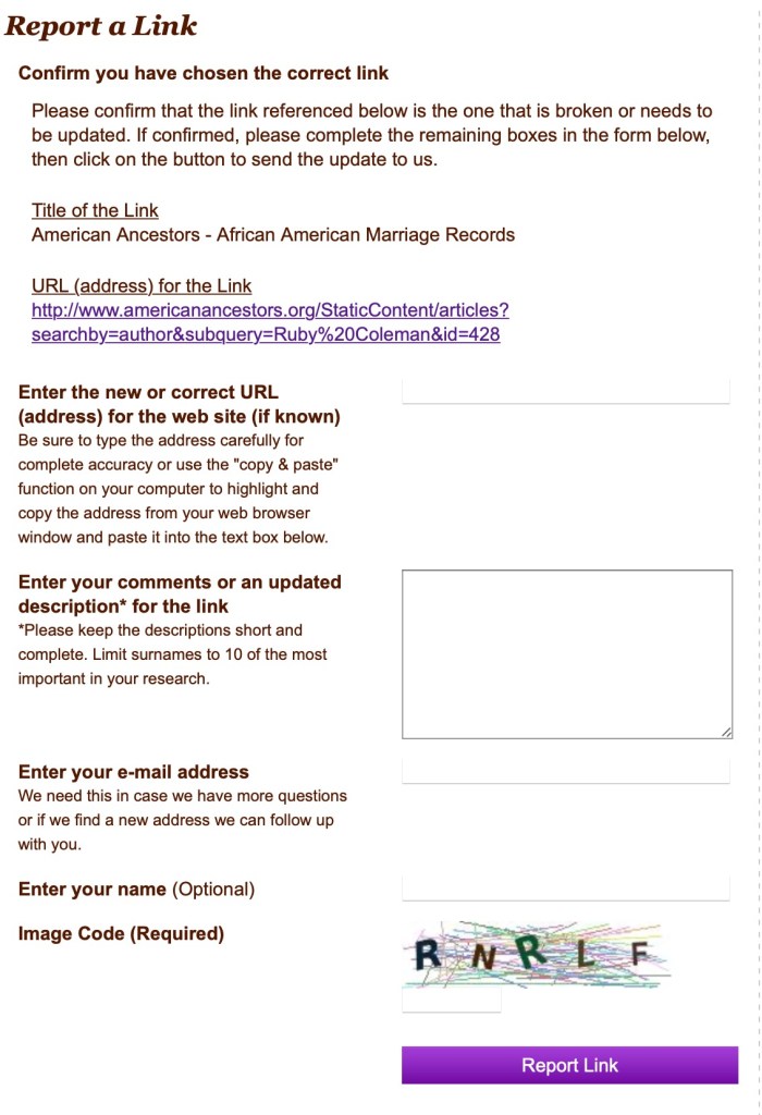
Should you immediately think “Aw, Cyndi’s List is so out of date. All of these broken links makes the site unusable!”? NO! The answer is no. And in case you tend to do that, please don’t. And here’s why. If there is an item on Cyndi’s List that you really want to see, that means it exists somewhere. And do you know who can and will help you find it (especially if you are polite and patient, and maybe send brownies)? Cyndi. She is a WHIZ at finding things that have moved online. So there is at least one thing you should do next when you encounter this: Report a Broken Link!
Reporting a Broken LinkClick on the broken link graphic next to the link you’re reporting.Report a broken link page at Cyndi’s List
Ok, so the above is the page you get when you report a broken link. At minimum, put your email address in there. If Cyndi finds a replacement link, she will let you know. She will! It’s happened to me! Seriously. She tries to help everyone and keep the site up-to-date. IF you can find the new home of that broken item, let her know. It will save her a bit of time. I did a quick search for that article at AmericanAncestors and didn’t find it (to be fair, I didn’t put a ton of time into it). So I just submitted it without comment. At some point, when Cyndi finds where they put it, she’ll send me an email telling me that the link has been updated.
So, that was us walking up and down the African-American aisle of Cyndi’s List. There are 229 categories (aisles) at Cyndi’s List. Get walking! We will discuss “shopping” at Cyndi’s List WITH a plan (shopping list) next time.
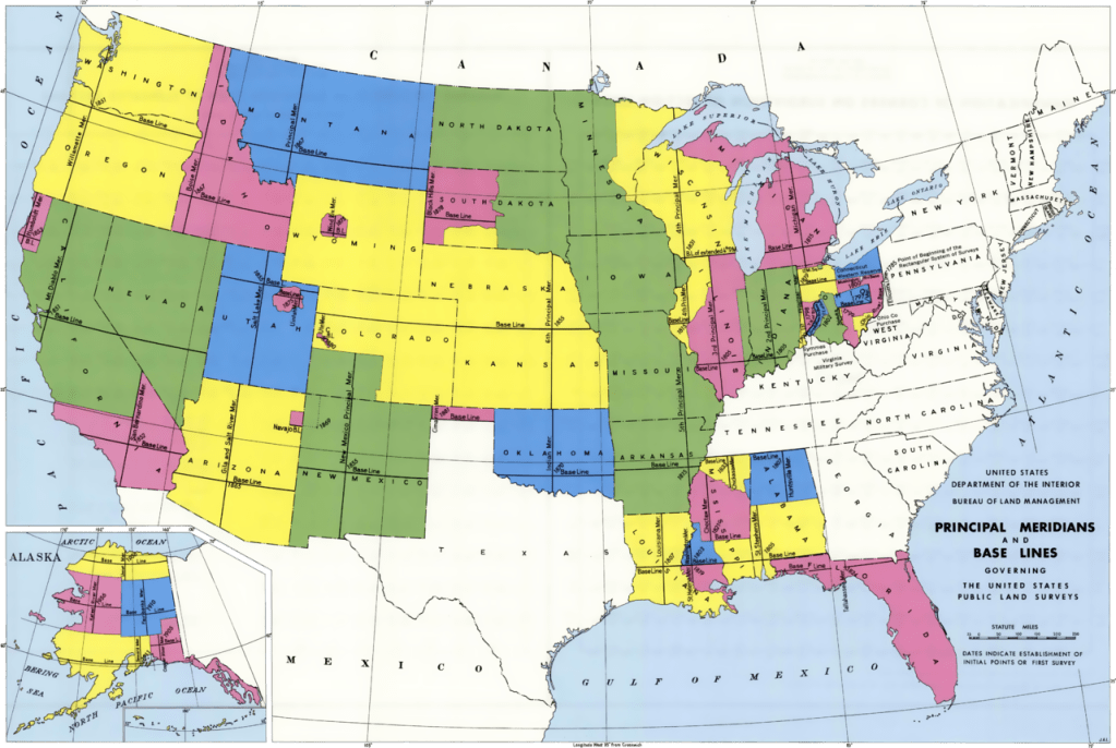
Last time we talked about the metes and bounds survey system that was used in the eastern states (colonies prior to our nation’s creation). This time let’s look at the survey system used the the rest of the United States, in the public lands states, called the “rectangular survey system.”
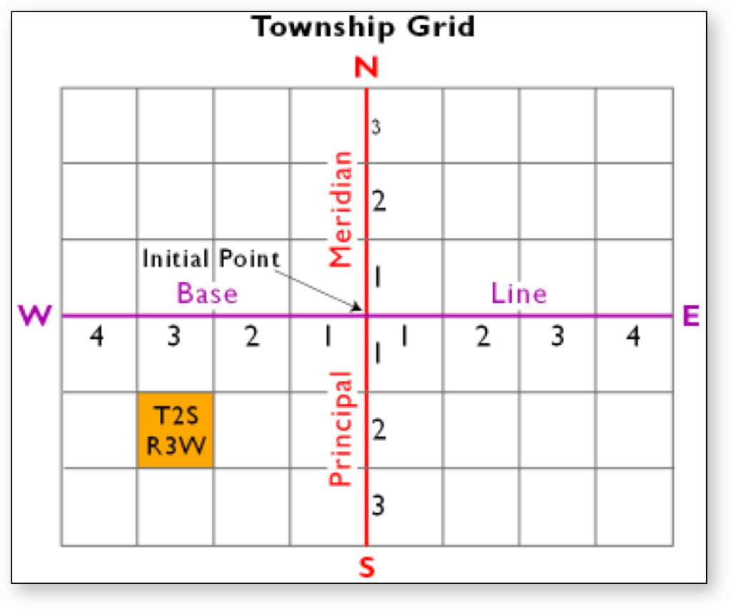
This survey is based on a grid system using a series of baselines and meridians across the U.S.
USGS BLM Map of Baselines and Meridians
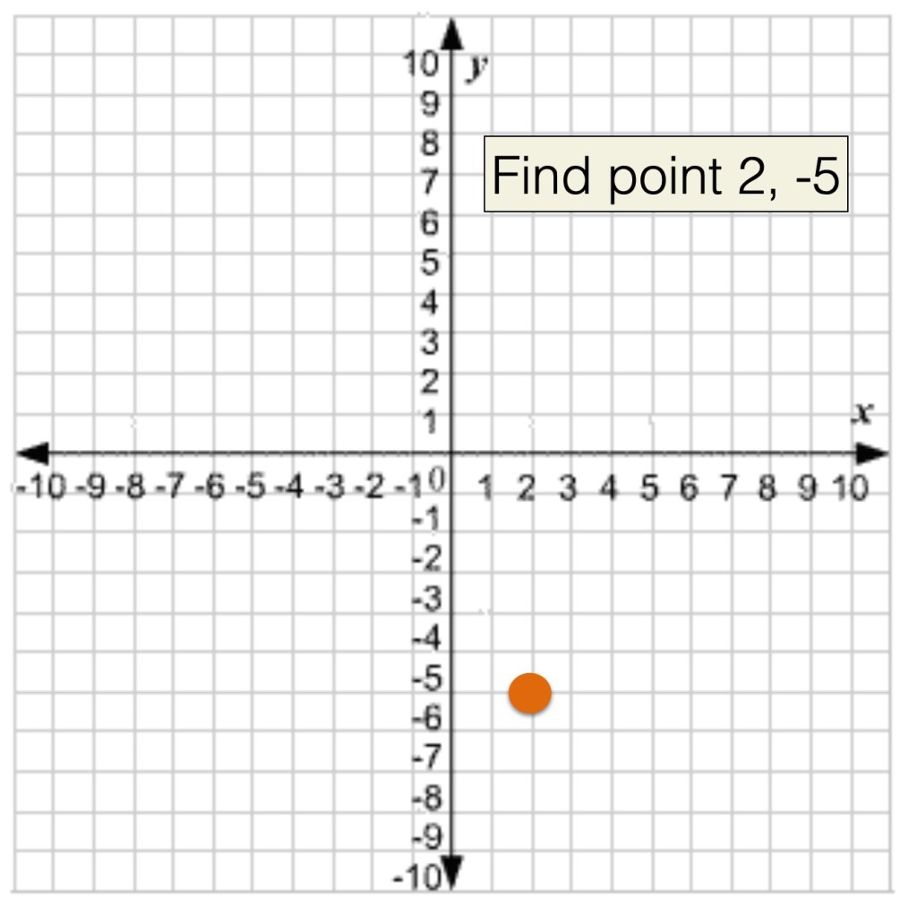
If you ever learned about how to find a point on a grid in math class you, learned that (2, -5) meant that you go right 2 points on the X axis, and down 3 points on the Y axis.
Grid system from math class.
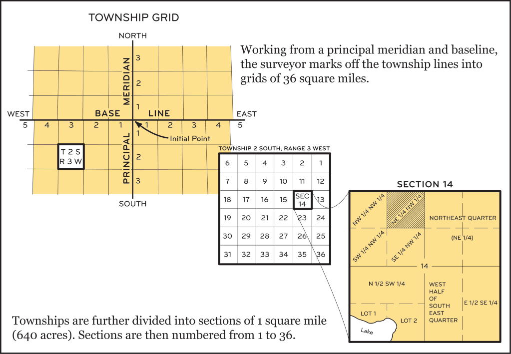
The rectangular survey works the same, except that we use the cardinal directions instead of positives and negatives, and the directions are referred to as townships and ranges such that a square from the grid is called “township 2 south, range 3 west.’ Each of these township/ranges is 36 square miles.
Example showing the location of township 2 south, range 3 west
But wait, there’s more…
Inside each one of those township and ranges, the land is further subdivided into 36 1-square mile sections, numbered 1-36. AND THEN, each one of those 1 square mile sections is further divided into “aliquots.” Those smallest sections are divided into halves or quarters depending on how many acres someone received.
The rectangular system divisions.
So, when you find a land description for a rectangular survey system piece of land, it will read like this: N 1/2, SW 1/4, of section 14 in township 2 s, range 3 w (or north half of the southwest quarter of section 14 in township 2 south, range 3 west). The land description might also mention the principle meridian though not always. From context of where the land is located, you can often figure it out without naming the meridian (refer to the first map in this post).
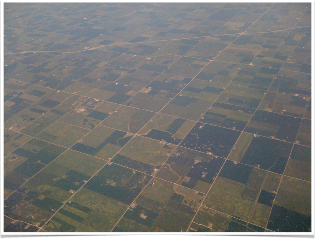
It is because of this grid system of surveying that this is the view out your airplane window when you fly over the midwest:
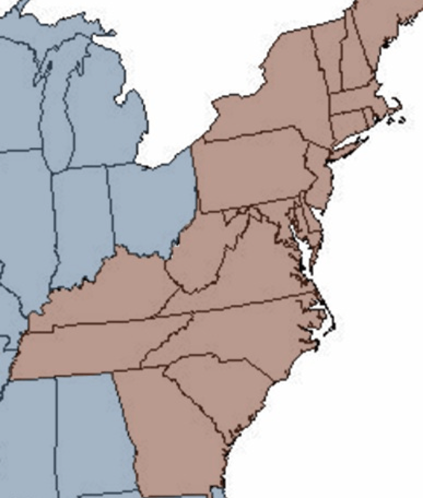
When working with ancestral land records, there are a few things you need to know in order to attempt to find your ancestors’ land on a map. In the United States there are two types of land surveying systems. They are known as the “state land states” which use the “metes and bounds” system, and the “public land states” or the “federal land states” which use the “rectangular” survey system.
The states that fall into the state land state category are those states created from the original thirteen colonies and Hawaii and Texas. (As a side note, Texas has its own land survey system because Texas was a country of its own before joining the U.S., with their own survey system already in place. See the Texas General Land Office for more information.) Those states are:
Connecticut
Delaware
Georgia
Hawaii
Kentucky
Maine
Maryland
Massachusetts
New Hampshire
New Jersey
New York
North Carolina
Pennsylvania
Rhode Island
South Carolina
Tennessee
Texas
Vermont
Virginia
West Virginia
The states in red in the map above are State Land States, plus Texas and Hawaii.
The land obtained by individuals for the first time usually was given by the colony or state. Records for those first land grants are kept at the state level, usually at a state archive, though the locations will depend on the state. Again, the state land states were surveyed using the “metes and bounds” survey system.
The Federal land states or “public land states” was land obtained by the federal government after independence. This means the rest of the United States. Primarily the land west beyond the Appalachian Mountains. After the Revolutionary War, land claimed in this western portion by state land states were ceded to the federal government. Additionally, the United States obtained land through various means such as the Louisiana Purchase, the War with Mexico (1846-1848), and so forth.
The land in the public land states would then be granted to individuals by the federal government. Those records are held at the national level, and many are digitized and available at the Bureau of Land Management General Land Office website. The land in the public land states were surveyed using the “rectangular” survey system.
Map from Bureau of Land Management. This map shows the Principle Meridians and Baselines used in the rectangular survey system.
When looking at a land description, you can usually determine quite quickly if you’re reading a metes and bounds or a rectangular survey. We will discuss the metes and bounds system next and the rectangular system after that.
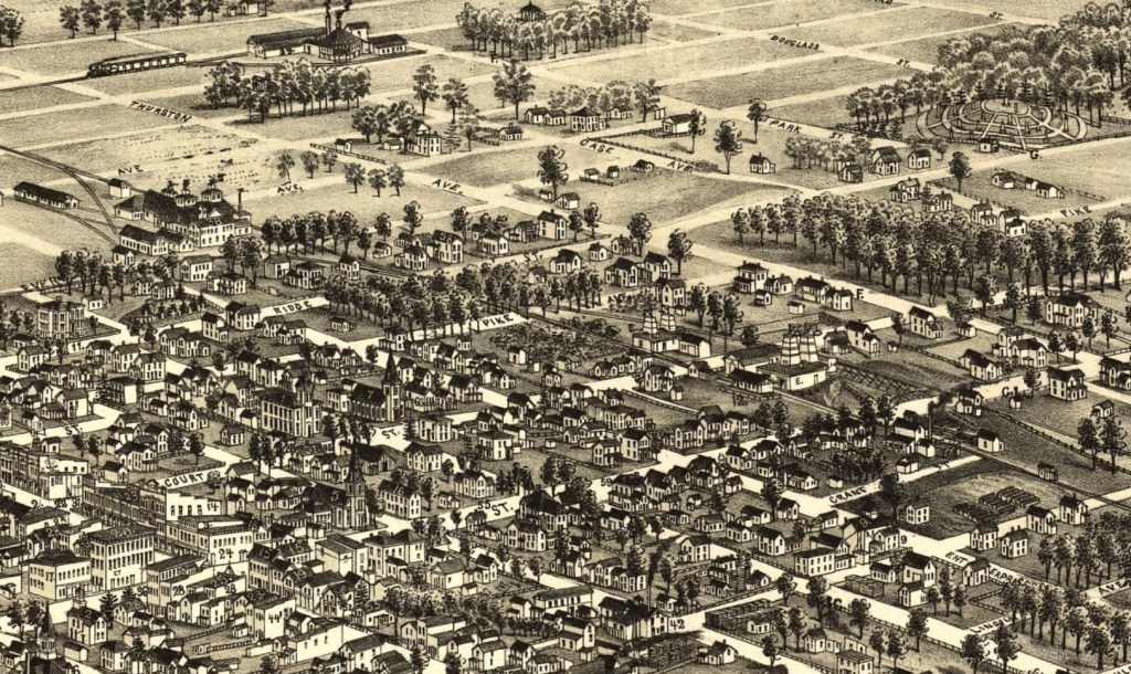
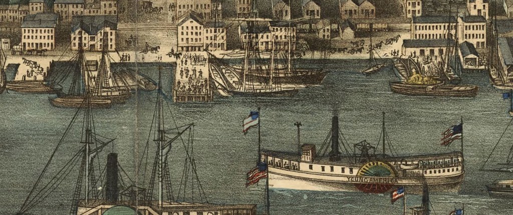
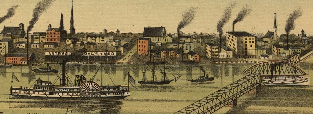
One of my favorite types of maps, especially for enhancing your imagination when thinking about your ancestors, is the bird’s eye view map. These are intricately drawn maps were popular in the late 1800s and early 1900s to depict towns and cities from above. These maps might be called other names such as panoramic maps, perspective maps, or aero view maps.
These maps may not be drawn to scale but rather they depict streets, buildings, waterways, and city life. Many of these are so intricate that if you zoom in you can see horses and buggies, names on the ships in the harbor, people walking, and more. They are art the informs our ancestors’ surroundings. For me, they are almost like stepping into a time-travel portal. Almost. They are so much fun to look at and imagine with.
Here are a few zoom-ins on some of my favorites:
Zoomed in on Bowling Green, Ohio, 1888, with Oak Grove Cemetery in the upper right corner, Library of CongressZoomed in on Alexandria, Virginia, 1863, with names on steam ships, horses and buggies, and people on the pier, Library of Congress.Zoomed in on Toledo, Ohio, 1876, showing the industry along the Maumee River, the Chief Justice Waite side-wheel steamer, and the swing bridge to let ships pass, Library of Congress.